Hike of the Week: Skelton Canyon Trail

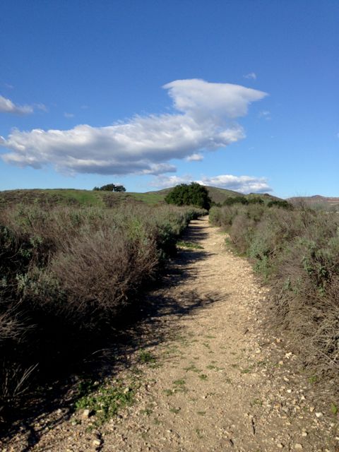
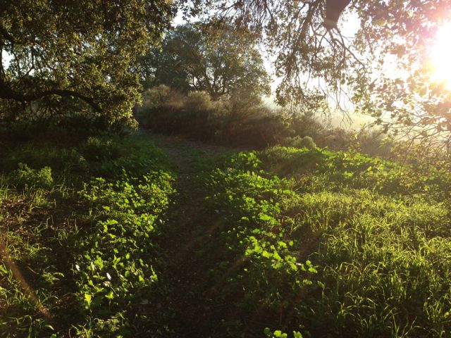
IMG_7811I don’t usually set out on a hike later than noon, but on a recent Saturday I had several hours with no plans, and I was itching to get out in the beautiful hills. This hike is perfect and the light was gorgeous as the sun started its descent.

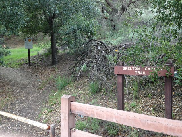
The Skelton Canyon trailhead is at the north end of Lakeview Canyon but before the gate that protects the beautiful houses in the hills. You can park on the street right near the sign. There is another trailhead on Westlake Boulevard but there is no convenient parking – you have to park across WL Blvd. on Santiago street.

skelton canyon trailhead

Because these hills are surrounded by houses on one side, Westlake High School to the south, and Westlake Boulevard to the west, there’s a lot of civilization noise and even music from the marching band if you go up there at the right time, so it isn’t a perfect spot to get away from it all. More like getting above it all. Since the hills are green and the poppies are blooming, there’s enough beauty to distract you.
IMG_7822

The trail starts out as a steep switchback-ey climb to the top where you are greeting by majestic oak trees and a mostly level wide path.
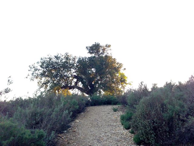
IMG_7819Almost to the top! (The first top.)

IMG_7784

The larger trail turns to the west and down the hill to the Westlake Boulevard trailhead.

IMG_7805Don’t go that way. Go the other way (to the right).

To continue up the hillside, you have to go mostly by feel at this time of year, because the trail itself is covered by mustard plant. With a satellite Google map it’s easy to orient yourself and push onward. If you continue along the wash, you’re going in the right direction.

IMG_7790View from not quite the tippity top. The depression the left is the “wash” I referenced above but I’m not sure if that’s what this formation is actually called.

The trail continues to the highest point in the hills…

IMG_7796..where someone has left a cairn for you. I added that little top rock.
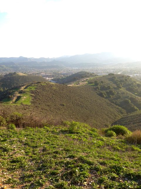
IMG_7800This is the top.

…and then descends over the top, where the terrain changes and more growth makes for even more beautiful hiking. It’s fun to look over the mansions in the canyon to the east and wonder who lives there and what it must be like to have this view.

You have to turn around and hike back out the way you came because the trail ends behind some more incredible houses. It’s about a mile and a half to this point, so a full 3 miles to hike in and back. Some of the terrain is pretty steep, so you’ll get a workout, plus you get to see all of this.

 

IMG_7814 Going back down the way I came. The reward was this glorious late afternoon light.

First Hike of the Year – Simi Peak and China Flats

IMG_7494China Flats, on the way up to Simi Peak

Thanks to a standing arrangement with my friend Deb, I take a hike about once a week, and usually somewhere that is new to me. Deb is an important part of this because without a person who will expect me to go somewhere, I will stay in my house sitting at my desk and basically just atrophying while the kids are at school. Also, she knows all the trails and she usually drives.

This week it was Simi Peak and a short jaunt through a mountaintop meadow called China Flats. Technical expertise on this hike can be found here at Nobody Hikes in LA. I’m just here to show you how amazeballs it is at the top:

IMG_7468

The first mile is a very do-able climb up. We were passed by a dog (and its owner).

IMG_7471

We stopped at a lower peak to get a geocache, because that is how we roll.

IMG_7475

Then the trail snakes around the back of the mountain and goes through these beautiful oak groves and meadows.

IMG_7479If you look closer you can see a hobbit.

IMG_7485

And here is the view from the top. That road that heads south off to the other mountains is Lindero Canyon.

IMG_7487

To the west you can see the ocean. Well, I guess you had to be there.

IMG_7493

Just hanging out. In that metal drum below me is a log book you can sign to show you reached the peak.

IMG_7495

Then we turned around and went back down the way we came up. It only took us about 3 hours, with a few breaks. I recommend!


Channel Islands Cruise, Starring Anacapa

 You’ve never visited the Channel Islands even though they are right here? What are you waiting for?

IMG_5904

Channel Islands National Park is one of those places about which my husband and I keeping saying “We should go there someday.” Well, I finally got to go there and trust me, you totally should.

Known as the Galapagos of Southern California because it is far enough away from the mainland that land animals have been left mostly alone to evolve and keep to themselves, the Channel Islands consists of Anacapa, Santa Cruz, Santa Rosa, and San Miguel Islands, in ascending order of proximity to Channel Islands Harbor to the west, and Santa Barbara Island to the south. Island Packers offers cruises and other trips out to all five islands where you can hike, camp, kayak, snorkel, or join conservancy projects like cleanups or fish counts.


Channel-Islands

In early October I joined a group of writers as a guest of Island Packers for a Wildlife Cruise to Anacapa. This trip consisted of a 90-minute ride out to the island, and then a sightseeing tour of its shoreline, helpfully narrated by Mike, who was a font of information about the island’s history and evolution.

IMG_0763

IMG_0772

IMG_0776

On the way to and from Anacapa, our boat, the Vanguard, passed through huge pods of dolphins, and some sharp-eyed passengers even sighted a whale spout out in the distance to the west. The dolphins came in several varieties, and they seemed to love having us as company.

IMG_0827

I took a zillion pictures of them, trying to capture their graceful arcs as they playfully jumped up to say hi, but they all look just like this one! Here is a video taken by one of the other writers on the trip.

The Vanguard isn’t exactly comfortable, but there are plenty of places to sit or lean against the balcony to watch the horizon or the sea lions lounging on the oil rigs as you pass. There is a snack bar in the galley, but you can also bring a bag of your own snacks. In fact, you can bring a tent and sleeping bags and everything to survive a night on a Pacific Island, because not only is this trip great for sightseeing, but it is also a shuttle for campers and day hikers. After the long and dolphin-strewn ride out to the island it was exciting to catch the first glimpse:

IMG_0838

That is Arch Rock to the left, the trademark of Anacapa Island and subject of many many photographs. Once we arrived at the landing cove, the boat had to be steadied next to the big pier so the people who were getting off could safely disembark. There was a group of Channel Islands eco team members going up to the island that day. One of them told me their job was to remove non-native plants. So basically, weeding.

IMG_5893

IMG_5895

IMG_0853The water is really this clear and blue in the landing cove at Anacapa Island.

IMG_0860

Once the daytrippers and campers disembarked, the rest of us were taken on a shoreline tour. This lighthouse is not manned and nobody lives in it, but you can hike all the way up to it. The foghorn sounds all day and night, even when there is no fog.

IMG_0864Again, the famous Arch Rock.

IMG_5914

IMG_0876

Along the east-facing side of the island, there were a few places of historical interest that narrator Mike pointed out.

IMG_0903This is called Keyhole Rock.

redwood cove

Nobody lives on the islands now (and the only mammal is a small mouse), but evidence suggests that the Chumash tribe visited the island as far back as 5,000 years ago. This spot is known as Redwood Cove. The Chumash used to come here to harvest the downed trees that landed here as driftwood to make canoes.

IMG_5898

I chose a spot on the top deck for this part of the tour to get better views.

IMG_0913

This spot is known as Frenchy’s Cove, named after Raymond “Frenchy” LeDreau, a hermit who lived here starting in 1928 selling fish and lobster and helping people with illegal shipments of alcohol during Prohibition.

After marveling at the mostly untouched beauty of the island, we headed back to shore, passing again through the dolphins. I was so moved by seeing the island up close that I longed to join the day hikers, so I vowed right then and there to return with my family sooner than later.

The weather that day was perfect – it started off chilly and windy and overcast, but by the time we arrived at the island the fog had burned off and the sun kept us nice and warm. The water that day was fairly calm, but it does happen that the waves get too big and choppy for a pleasure cruise. Even if you buy a ticket in advance there is always a chance that the trip will be cancelled due to unsafe conditions, so keep that in mind if you go.

This particular trip is $37 for adults with lower rates for children and seniors. There is a variety of different destinations and trip lengths and types on offer, so I encourage you to explore the website and start planning to satisfy your wanderlust. Since the Channel Islands are so close, there’s really no reason to put it off any longer.

Island Packers
Channel Islands Wildlife Cruise – Anacapa
1691 Spinnaker Drive Ventura, CA 93001
805-642-1393